-Jg:正交投影
正交方位投影是一种从无穷远距离处的透视投影,因而常用于绘制从外太空看地球。与Lambert等面积投影以及立体投影类似,一次只能看到一个半球。该投影既不是等面积也不是保角,在半球边界处有较大得畸变。从投影中心出发的任意方向是真实的。
该投影的参数为:
-JGlon/lat[/distance]/width 或 -Jglon/lat[/distance]/scale
- lon/lat 是投影中心位置
- distance 是边界离投影中心的度数,默认值为90
- scale 地图比例尺 1:xxxx 或 radius/latitude (radius 是纬线 latitude 与投影中心在图上的距离)
gmt coast -Rg -JG-75/41/4.5i -Bg -Dc -A5000 -Gpink -Sthistle -png GMT_orthographic
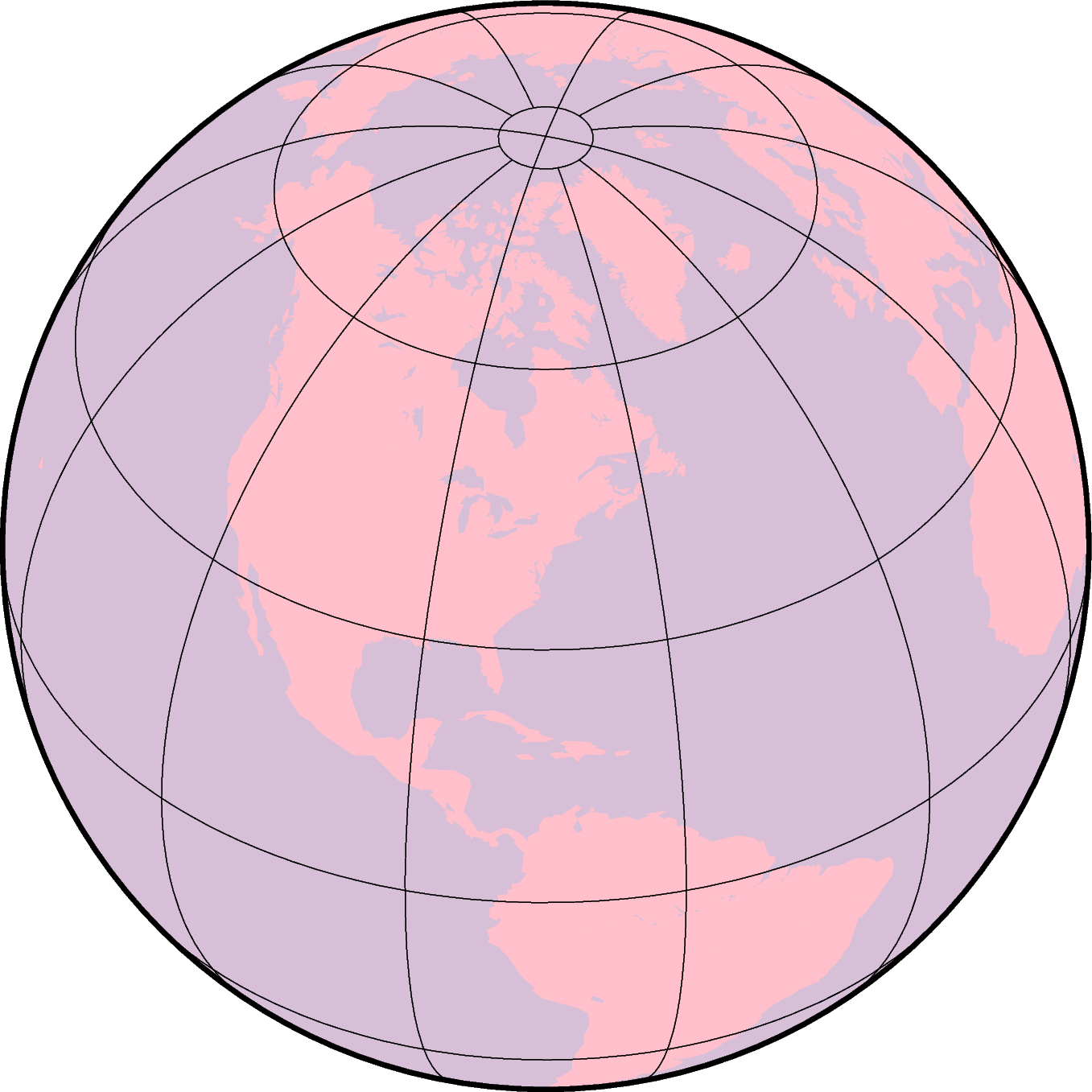
使用正交投影绘制半球
-Jg 加上更多的参数时还可以用于绘制透视投影,以在二维平面内模拟从太空看三维的地球。具体的参数为:
-JGlon/lat/alt/az/tilt/twist/width/height
- lon/lat 投影中心的经纬度
- alt 是观察者所处的海拔,单位为km。若该值小于10,则假定是观察者相对于地心的距离,若距离后加了 r,则表示观察者与地心的距离(单位为km)。
- az 观察者的方位角,默认值为90度,即从东向观测
- tilt 倾角(单位为度),默认值为60度。若值为0则表示在顶点直接向下看,值为60则表示在顶点处沿着水平方向30度角的方向观察
- twist 扭转角度,默认值为180度。This is the boresight rotation (clockwise) of the image. The twist of 180° in the example mimics the fact that the Space Shuttle flies upside down.
- width/height 是视角的角度,单位为度,默认值为60。This number depends on whether you are looking with the naked eye (in which case you view is about 60° wide), or with binoculars, for example.
- scale as 1:xxxxx or as radius/latitude where radius is distance on map in inches from projection center to a particular oblique latitude
gmt coast -Rg -JG4/52/230/90/60/180/60/60/5i -Bx2g2 -By1g1 -Ia -Di -Glightbrown \
            -Wthinnest -Slightblue --MAP_ANNOT_MIN_SPACING=0.25i -png GMT_perspective
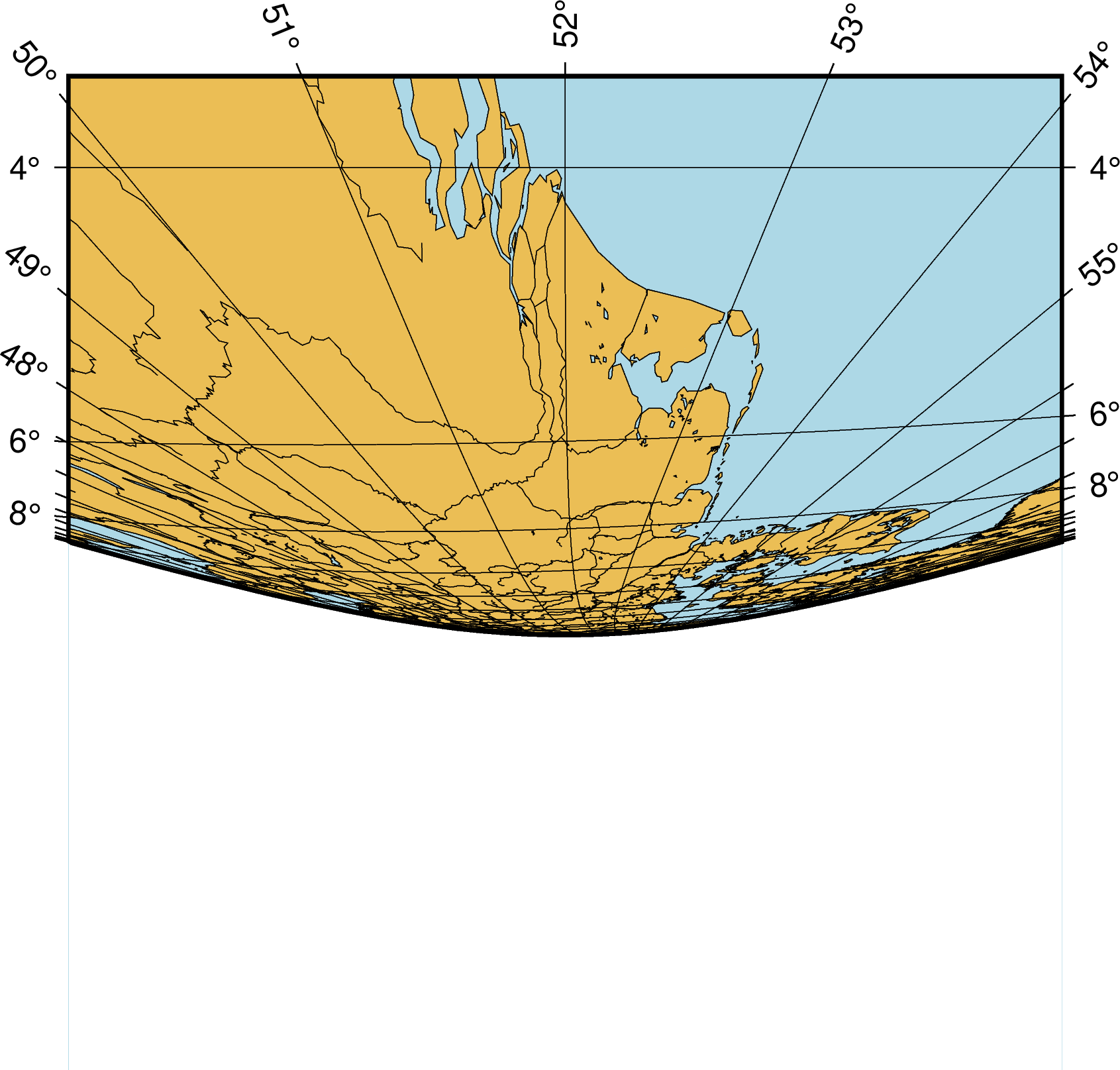
透视投影